Urban Data Stories are narrated analyses of urban datasets that explore a particular aspect of a place. Their goal is to help a wide range of stakeholders, such as local planning authorities, property developers or citizens, to explore local challenges and opportunities through bottom-up analysis of local data.
Context
The stories use open and local data to make urban conditions easier to explore and communicate.
My role and contribution
Data scientist. I performed the data analysis and story writing.
How it works
The analyses combine data preparation and analysis with spatial methods or statistical techniques, then present the results through visualizations. Two examples are:
Service access within walking distance
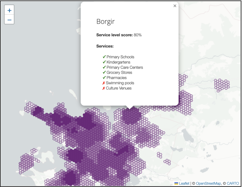
This analysis combined open public-sector datasets from Iceland to show how many essential services are within walking distance of neighborhoods in the Icelandic Capital Region. Road-network analysis was used to calculate walking distances, with spatial visualization tools supporting interactive exploration.
Pricing of Energy Performance Certificates
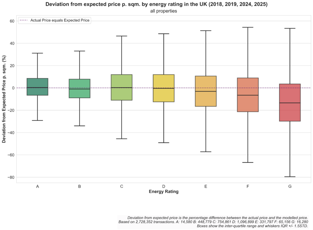
This analysis combined two open public-sector datasets from the United Kingdom to investigate the potential relationship between Energy Performance Certificates and residential real-estate prices. The work involved data cleaning, address matching, statistical analysis, and data visualization.
Outcome
The analyses were published as Urban Data Stories. See the full collection, including:
Technology
Python, GeoPandas, OSMNx, PyTorch, spatial informatics, statistics, regression analysis